GeoAI Suite for QGIS
QGeoAI is an extension suite for QGIS designed to support professionals in producing artificial intelligence processes applicable to geospatial data. It covers all stages, from annotation to inference, including training and powerful preparation and post-processing tools.
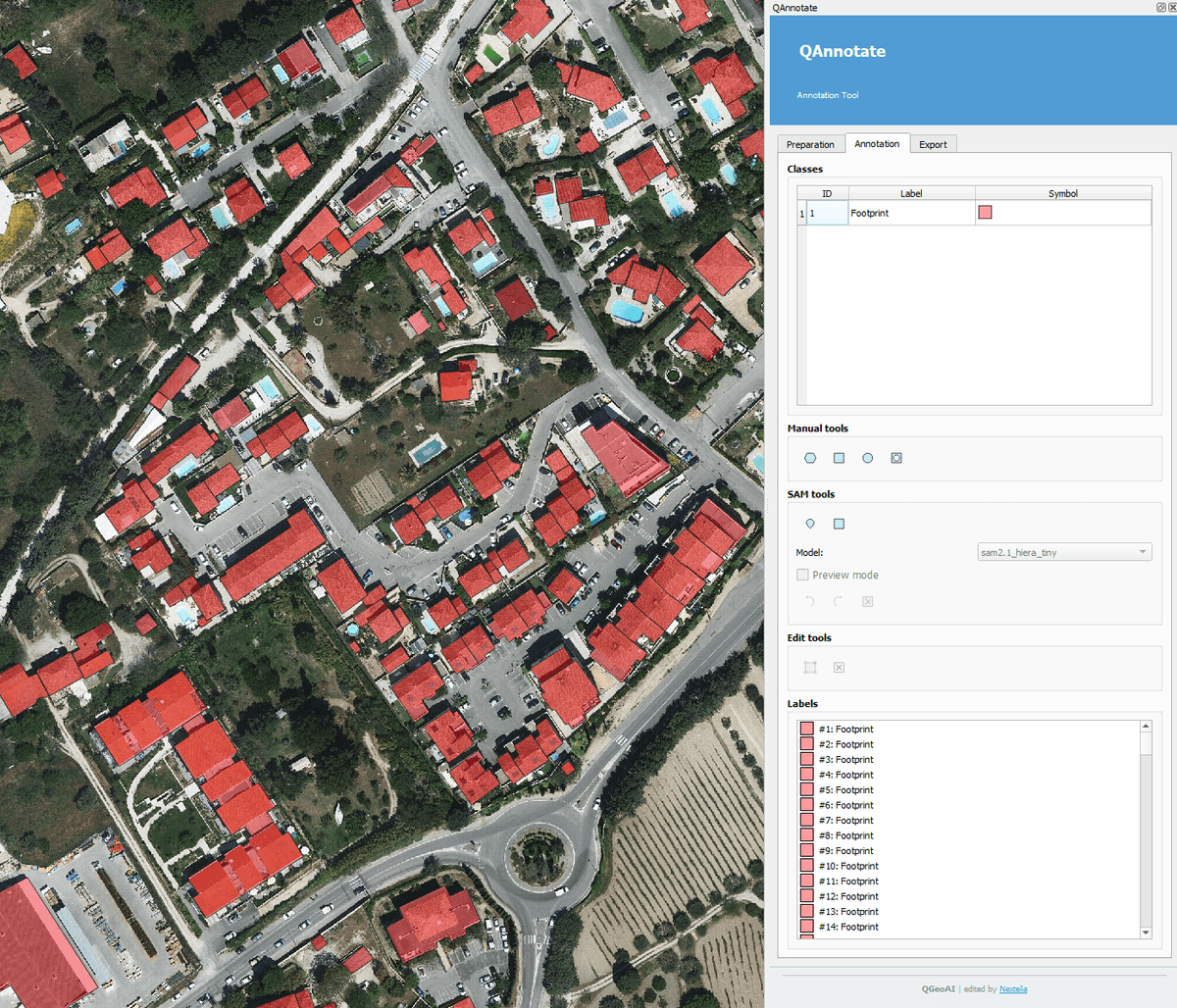
QAnnotate
Quickly create annotated datasets ready for model training.
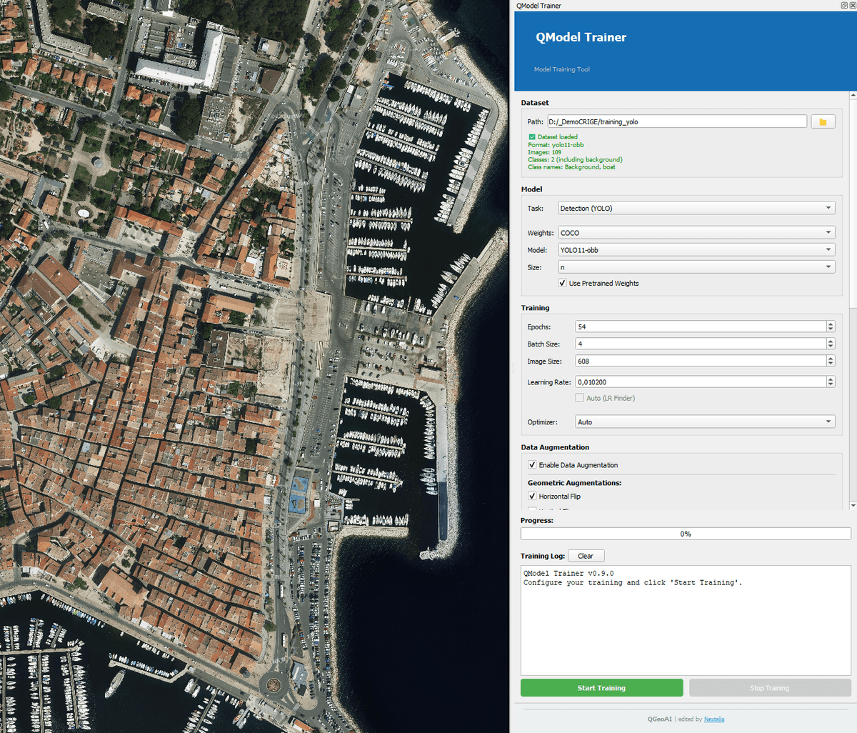
QModel Trainer
Train your deep learning models directly in QGIS with full control over parameters and data augmentation.
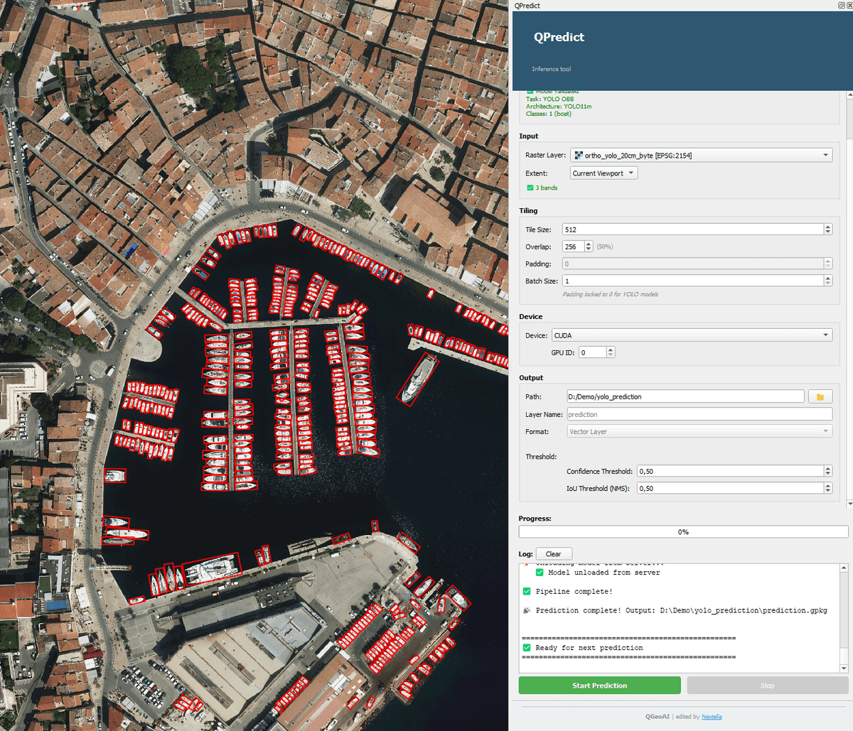
QPredict
Apply your trained models to produce immediately usable raster or vector layers.
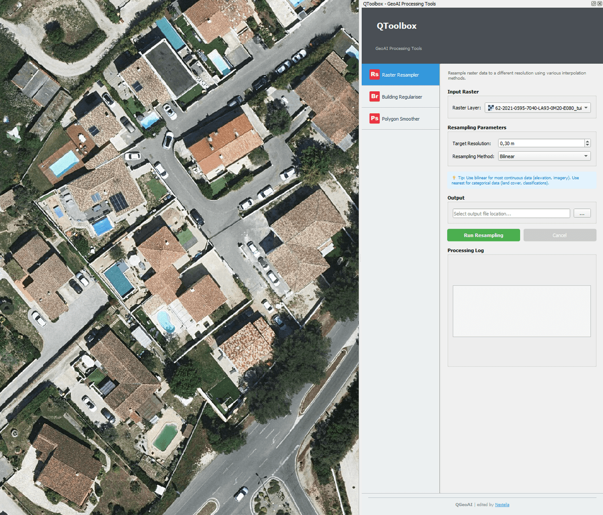
QToolbox
Prepare upstream and post-process downstream your raster and vector data for complete GeoAI workflows.
Beyond technical features, QGeoAI is a structured response to the real needs of organizations that want to leverage AI with confidence, particularly:
- local authorities and their GIS departments,
- urban planning agencies and consulting firms,
- private companies integrating GeoAI solutions into their processes.
Using QGeoAI involves important methodological choices (data quality, model selection, critical interpretation of results, integration into business workflows). For this reason, Nextelia offers support, maintenance, training, and custom model development services to transform a powerful tool into sustainable operational capability, tailored to your specific business challenges.
The rest of this documentation presents:
- the technical components of QGeoAI, to understand how they work,
- as well as resources to support you in their use.